Representing vegetation cover
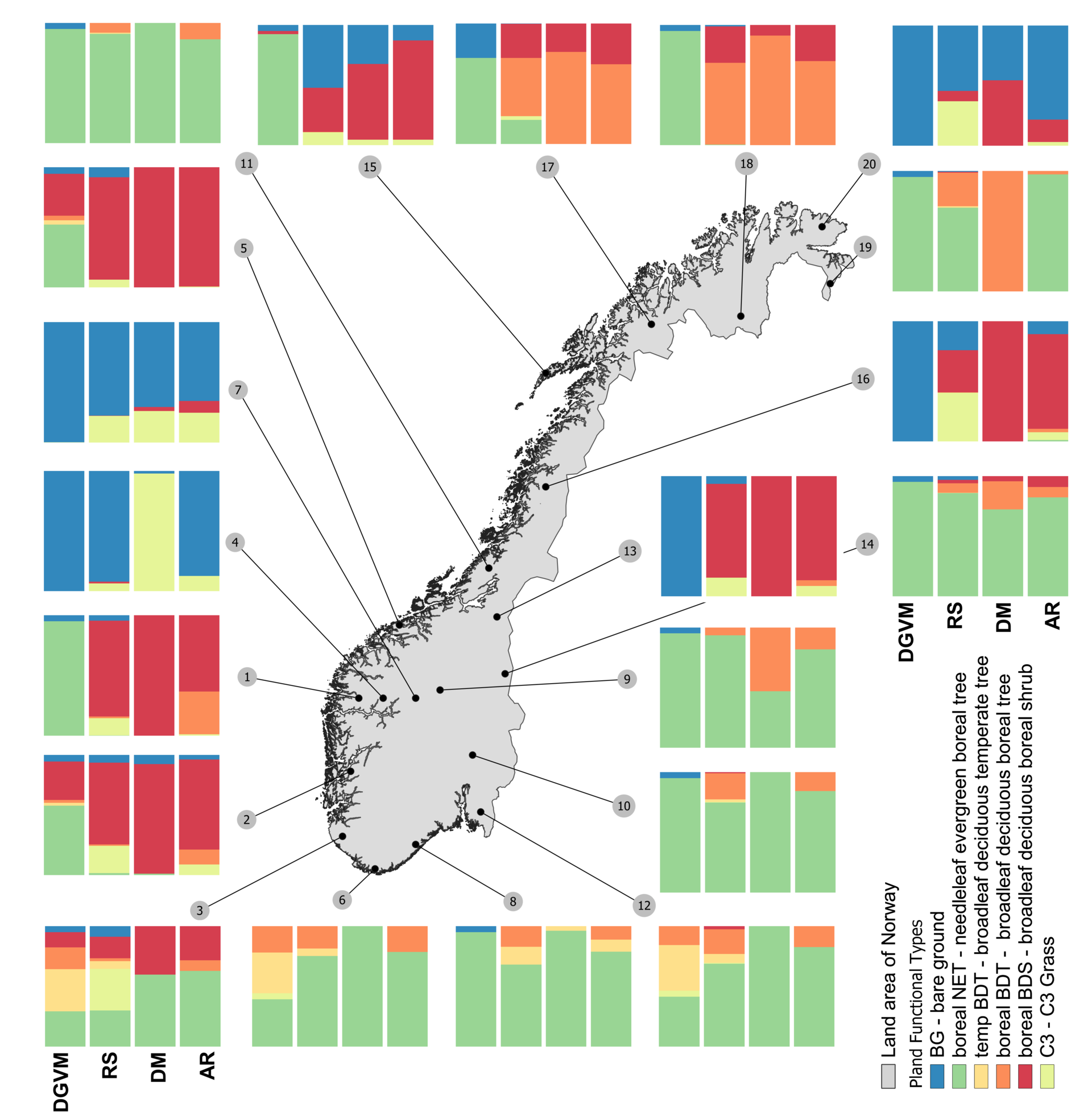
Vegetation is an important component in global ecosystems, affecting the physical, hydrological and biogeochemical properties of the land surface. To capture future spatial and temporal changes in vegetation cover and its feedbacks to the climate system, dynamic global vegetation models (DGVMs) are included as important components of land surface models. Variation in the predicted vegetation cover from DGVMs therefore has large impacts on modelled radiative and non-radiative properties, especially over high-latitude regions. In this study, the authors evaluate the performance of three methods for spatial representation of present-day vegetation cover with respect to prediction of plant functional type (PFT) profiles – one based upon distribution models (DMs), one that uses a remote sensing (RS) dataset and a DGVM (CLM4.5BGCDV; Community Land Model 4.5 Bio-Geo-Chemical cycles and Dynamical Vegetation). PFT profiles obtained from an independently collected field-based vegetation dataset from Norway were used for the evaluation.
A flavour of the results
The authors found that RS-based PFT profiles matched the reference dataset best, closely followed by DM, whereas predictions from DGVMs often deviated strongly from the reference. DGVM predictions overestimated the area covered by boreal needleleaf evergreen trees and bare ground at the expense of boreal broadleaf deciduous trees and shrubs. A series of sensitivity experiments was performed to investigate if addition of new thresholds identified by DM improve the performance of the DGVM method. Based on the results, the authors suggest implementation of one of these novel PFT-specific thresholds for establishment (i.e. precipitation seasonality) in the DGVM method. The results highlight the potential of using PFT-specific thresholds obtained by DM in development of DGVMs in broader regions. The authors also emphasize the potential of establishing DMs as a reliable method for providing PFT distributions for evaluation of DGVMs alongside RS.